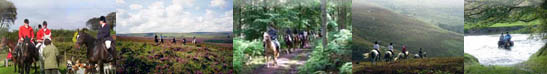
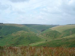
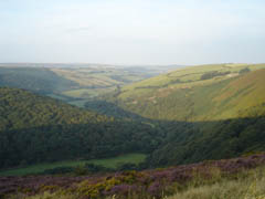
Although ride 6 starts and ends in Malmsmead, like ride 7, it takes quite a different sort of route. Predominantly the first half of the route winds along Exmoorâs beautiful and dramatic coastline, offering stunning views out across the Bristol Channel to Wales. For the second half of the route you head in land up and over some of Exmoorâs finest open heather moorland.
Another interesting aspect of this route is that it passes features, and indeed runs through an area, that has helped inspire some of Exmoorâs more famous celebrities, the Romantic Poet, Samuel Taylor Coleridge and RD Blackmore, author of the famous novel Lorna Doone.
Points of Interest and Ride details
(Please note that the information below is not a route description. It is designed to add value to the descriptions that will be available in the Exmoor & Quantock Hills on Horseback publication in the New Year)
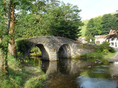
Malmsmead is easy to find. Follow signs for Brendon and Oare from the A39. The roads are tight but it is a scenic and enjoyable drive. A large car park is available just before you come to the bridge in Malmsmead (if you are coming from Brendon), or round to the right after the bridge (if you are coming from Oare). The car park is in front of Oaremead Farm Campsite.
There is a car park, toilets camping and caravanning site and natural history centre at Malmsmead, as well as a tea shop during the summer season.
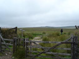
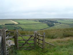
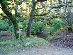
On leaving the car park turn left and head round to the left towards the bridge, cross the bridge or ford (depending on how high/fast the river is!). Out of Malmsmead take the first road left and then left again onto the bridleway that takes you up to County Gate. At the top take a brief rest and take in the views that look across to Southern Wood and down into Doone Country.
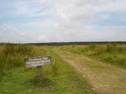
At County Gate you will find a car park, toilet facilities and a National Park Centre (open April to October), and therefore a good alternative base to begin ride 6 from.
Dartford warblers have recently started breeding on the coastal heath land at County Gate. Formerly more associated with more lowland heath land areas they first bred on Exmoor in 1995 and there are now over 70 pairs across the National Park.
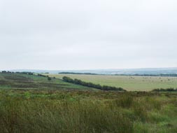
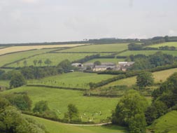
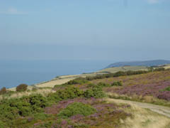
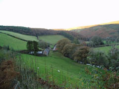
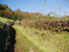
The route now crosses the A39 and winds east along the coast, travelling over open moor and heath land, through traditional working farms, and offering stunning views of the Bristol Channel and Wales.
Exmoor âs coastline, particularly the stretch that you are riding close to, and above at this point, is regarded as one of its most special qualities â for a number of reasons:
Exmoor has the highest coastline on the British mainland. It reaches a height of 314 metres (1350ft) at Culbone Hill.
The Exmoor shoreline is also the most remote in England. Because of the height and steepness of the cliffs, there is no landward access to the six mile stretches of shoreline from Combe Martin to Heddon's Mouth and Countisbury to Glenthorne and there are few places where you could land even a small boat. It is estimated that if you were to wait for tides low enough to walk between access points it would take five years to walk the 34 mile length of shore. Even then some serious rock climbing would be involved.
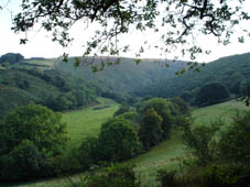
Exmoor has the most extensive broadleaved coastal woods in Britain. Woods stretch along ten miles of cliff from Countisbury to Porlock. Parts are ancient sessile oak woodland and are amongst the most natural woodland in England. Elsewhere strong salt-laden winds prevent the development of coastal woods except around sheltered inlets. On Exmoor the coastline is sheltered from the prevailing south westerly winds by the high cliffs and the Foreland shelters the eastern part of the coast from most strong winds sweeping up the channel. On the gentler parts of the cliffs trees sweep right down onto the beach.
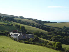
After Silcombe Farm you will pass a gate and track to your left that heads down to Culbone church, which is charmingly set in a shady wooded combe. Dedicated to St Beuno and with Saxon origins, it is reputed to be the smallest parish church in England.
Further on is Ash Farm, which is said to be the place where the Romantic Poet, Samuel Taylor Coleridge (1772-1834), wrote much of his famous poem Kubla Khan. Both Coleridge and his friend William Wordsworth lived for a time in the Quantocks and took much of their inspiration from walking far and wide throughout Exmoor and the Quantock Hills.
As you head back towards the A39, you pass a World War II anti aircraft battery site. It was used to defend a listening installation, on Stent Hill, which monitored enemy activity over the Bristol Channel. As you travel towards the Culbone Inn, the platforms of Nissen huts, which provided accommodation for the troops, can be seen on the right hand side of the road.
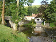
You cross the A39 at the Culbone Inn, which provides a suitable rest stop, being about half way. On leaving the Inn you travel down towards Robberâs Bridge, a popular picnic spot on Weir Water. It is a tiny road bridge, reputed to be the site of a Doone robbery (see notes on Lorna Doone in ride 7).
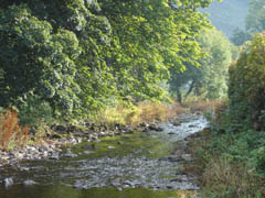
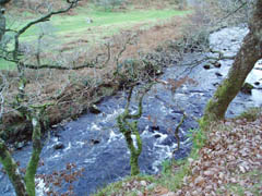
As you travel along Oare Water, watch out for Dippers â a charismatic brown bird with a white bib which dives underwater in search of food. Otters also frequent this watercourse, although being active during the evening and early morning they are rarely seen.
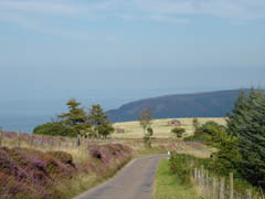
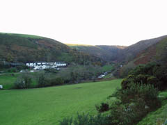
At Oareford ride 6 leaves the road and climbs, left, up Stowey Ridge, before turning right at the top and descending to Oare. Here you will find yourself out on open moorland with great views down through the rolling valleys.
The route then crosses back over Oare Water at Oare, before crossing back again and into Malmsmead, over the bridge, round to the right and the car park.
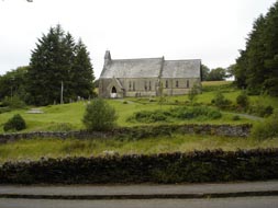
To the west of Malmsmead is the larger settlement of Brendon, itself a beautifully picturesque place. Here you will find a pub and small shop. The village straggles along the East Lyn valley with the church nearly two miles away. The church was moved from Cheriton in the eighteenth century and is dedicated to St Brendan, the much-travelled Irish saint who is reputed to have discovered North America.
Further west the road meets the B3223. If you turn right here you will come to the beautiful Watersmeet, owned by the National Trust. Open from 19 th March to 30 th October, there is a tea room and gift shop available.
For further information on things to do in the area and places to stay please visit Lynton Tourist Information Centre, County Gate National Park Centre (Summer Only) or Barbrook Post Office (Exmoor National Park Local Information Point).
Website:www.exmoor-nationalpark.gov.uk
|