| Editorial
Section - UK South West Region - The Blackdown Hills |
|
|
Contact
details
Halifax
House, Hemyock, Devon EX15 3QW
Telephone 01823 680681
www.blackdown-hills.net
|
THE
BLACKDOWN HILLS |
|
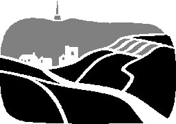
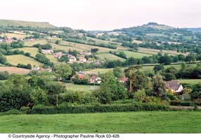
The
Blackdown Hills were designated as an Area of Outstanding Natural
Beauty in 1991. They form a readily identifiable landscape straddling
the border of Somerset and Devon and stretch from the M5 in the
north to Honiton and Axminster in the south and from Chard in the
east to Culmstock in the west.
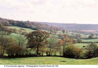
The AONB covers
360 square kilometres and sits between 150 metres and 310 metres
above sea level. It is characterised by a sense of relative remoteness
and tranquillity and embraces a diverse range of landscapes. From the dramatic,
steep wooded north facing scarp the AONB dips gently southwards
as a flat topped plateau, deeply dissected by valleys. On the tops
there are wide open windswept spaces, whilst in the valleys nestle
villages and hamlets surrounded by intricate and ancient patterns
of small enclosed fields and a maze of winding high-hedged lanes.
Its value to both residents and visitors alike lies in the integrity
and tranquillity of the landscape as a unit of English countryside
relatively unchanged over the last 200 years.
|
|
How
The Blackdown Hills came to be designated an AONB...
The
rationale for AONB designation being applied to the Blackdown Hills
lies in four main areas, identified in the 1989 Landscape Assessment
(Countryside Commission):
|
A.
An Isolated and Unspoilt Rural Area �
The area has been relatively undisturbed by modern development and
so ancient landscape features, special habitats, historical and archaeological
sites have remained intact. The traditional pattern of villages, hamlets,
paths and roads remain largely unchanged and there is an identifiable
and characteristic vernacular, pastoral landscape.
B.
Diversity of Landscape Patterns and Pictures
The visual quality of the area is high and is derived from the complex
patterning and mosaic of landscapes. Although the scenery is varied,
patterns and features are repeated again and again. Hedgerows delineate
the fields and define the character of the landscape, enclosing narrow
twisting lanes. There are long views over field patterned landscapes,
high lying plateau dissected by steep valleys supporting a patchwork
of woodland and heath, and fine avenues of beech along the ridge. |
C.
A Unique Geology �
The geology of the Blackdowns together with the adjoining East Devon
AONB is unique in Britain. Although very rarely seen, the geology
defines the topography giving rise to the flat plateau, sharp ridges
and spring-lined valleys. The springs in turn have created the characteristic
pattern of rough grassland, mire and wet woodland vegetation. The
non-calcareous nature of the Greensand rock has led to diverse plant
communities. Moreover the geology has provided the predominant vernacular
building stone, the chertstone which shapes the character of much
of the built-up environment.
D.
A Landscape with Architectural Appeal
The landscape pattern is punctuated by many small villages, hamlets
and isolated farmsteads of architectural value and distinctive character.
Devon and Somerset are recognised nationally for their fine rural
architecture but the Blackdowns contain a significant cluster of well
preserved buildings where the architecture is particularly well defined.
The predominant materials are chert and cob, with thatch, clay tiles
and corrugated iron commonly found. The appeal lies in the way in
which the buildings blend and fit into the surrounding working landscape. |
|
The
Visual Character of the landscape
The landscape
assessment identified five different types of landscape that are
seen in the Blackdown Hills:
|
|
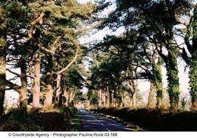
Northern
Escarpment
Dramatically
steep and well wooded northern scarp. Linear east-west topography
emphasised by a straight road running along the top. Also, small
hedged fields.
Wooded
Ridge
Softer and more
rolling eastern extent of the escarpment. Well wooded, including
conifer plantations. Avenues of mature beech trees on the banks
alongside roads. |
Upland
Plateau
Gently
undulating land crossed by long, straight roads bounded by mostly
beech hedges and isolated mature trees. Larger fields of mostly
improved pasture.
Rolling
Ridgeland
Long fingers of ridgeland similar to the plateau, but the topography
is more rolling, with smaller fields and avenues of trees along
roadsides. Tremendous views across the valleys.
|
|
|
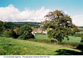
River Valleys �
Four main river valleys with same basic features of heavily wooded upper slopes spilling down into pasture, hedge and hedgerow trees. Numerous small, winding roads and isolated farmsteads. |
The
Natural Environment
The Blackdown Hills support a wide range of semi-natural wildlife
habitats, the distribution of which is closely linked to the area's
geology and topography. Many of the habitats are of national and
regional importance.
|
|
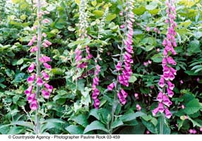
Grasslands,
Heathland and Mire:
Typical of Hense
Moor, Southay and Gotleigh Moor, Stockland Turbaries. Species found
here include Purple moor grass, rush pasture and other mires. Devils
bit scabious, heath spotted orchid, marsh and meadow thistle, marbled
white butterfly, small pearl-bordered fritillary, marsh fritillary,
keeled skimmer dragonfly, barn owl, curlew, snipe.
|
Hay
meadows and other species-rich grasslands � (neutral and calcareous)
These areas include Quants and Quarry Farm Fields. Common species
include Common knapweed, birds foot trefoil, cowslip, corky-fruited
water dropwort, pepper saxifrage and common spotted orchid, green
winged orchid meadow brown butterfly, gatekeeper butterfly , marbled
white butterfly, barn owl. |
Lowland
heathland, wet heath and acid grassland �
Typical of Black Down and Sampford Common. Species that are found
include Ling Heather, bell heather, cross leaved heath & western gorse,
bristle leaved bent, bracken, sheeps fescue, heath bedstraw, tormentil,
lousewort, stonechats, tree pipits, grayling butterfly, dingy skipper
and green hairstreak, nightjar. |
Hedgerows
�
These are extensively found throughout the Blackdowns. They are rich
in species such as Ash, hazel, oak, field maple, hawthorn, blackthorn,
willow, holly, beech, variety of woodland ground plants such as wood
anemone, primrose, gatekeeper butterfly, brown hairstreak, bullfinch,
bats, dormouse, common lizards. |
|
Woodlands
Wet
woodland
Ruthersleigh Moor is the best example of wet woodland. It is rich
in grey willow, goat willow, alder, downy birch, ash, oak, tussock
sedge, high pendulous sedge, kingcup, great horsetail, opposite
leaved saxifrage, redpoll, siskin, woodcock.
Ancient
broad-leaved woodland
Priors Park and Adcombe Woods are well known sites of ancient woodland.
Species found here include Ash, field maple hazel small leaved lime,
wild service tree, pedunculate oak, beech, hawthorn, blackthorn,
spindle, dogwood wayfaring tree bluebell, primrose, wood anemone,
red campion, lords and ladies, stinking iris, speckled wood ringlet
butterfly, purple hairstreak, Wood white, silverwashed fritillary,
wood warbler, redstart, dormouse, small pearl-bordered fritillary.
|
Rivers
and streams
The rivers and
streams of the Blackdowns are bursting with life, including kingfishers,
dippers, grey wagtails, otters and trout. |
SITES
OF SPECIAL SCIENTIFIC INTEREST (SSSI)
There are 16 SSSIs
in the Blackdown Hills ranging from the 156 hectare Blackdown and
Sampford Commons to Reed Farm pit at just less than 1 hectare. In
total they cover 640 ha, or just under 2% of the AONB. Of these SSSIs
79% are deemed by English Nature to be being positively managed. In
addition, one site, Quants, is a candidate for Special Area of Conservation
(cSAC). These are designated under the EC Habitats Directive as internationally
important habitats. |
|
Historical and Cultural Heritage
The
remarkable amount of historical and archaeological remains that
survive `relatively undisturbed by modern development' are one of
the reasons for the Blackdowns designation as an AONB. They range
from the Stone Age to WWII and our knowledge of them continues to
grow.
|
|
Early
Man
The landscape
of the Blackdown Hills has been shaped and modified by man; from
early human hunters to modern farmers and householders, the landscape
continues to evolve and change. Evidence of early human activity
in the Yarty valley is provided by finds of flint and chert tools
and Bronze Age man left his mark with barrows such as those at Robin
Hood Butts up on the plateau.
Iron
Age - Roman Britain
Iron Age Hill forts, including the strongly defended sites of Dumpdon
Hill, Hembury and Knapp Hill, dominate the fringes of the AONB.
However, evidence of Romano-British settlement is rare. Castle Neroche
built on the northern escarpment overlooking the Vale of Taunton
was largely established in its present form shortly after the Norman
invasion, although there is evidence from both earlier Iron Age
use and later, the large motte was added.
Medieval
Influences
The managed woodland of Neroche Forest to the east of the Castle
was used by many parishes in the area and although the Forest was
enclosed into fields in the 1830s traces of woodbank survive.
Much of the existing settlement pattern will have originated in
the medieval period; a pattern based on dispersed hamlets and farmsteads.
Many of
the irregular fields and massive hedges found in the valleys, such
as around Clayhidon, represent land taken directly into cultivation
from woodland probably by the time of the Norman conquest. The pollen
record shows that in medieval times the woodland of the area was
being increasingly cleared to make way for agriculture. There is
little evidence of large medieval open fields, although strip fields
have been noted along the eastern part of the AONB.Many
abandoned farmsteads and hamlets arise from the medieval period,
established on areas of marginal land during times of great agricultural
prosperity. Jacob's City at Clayhidon is one example, although many
such sites survive as earthworks.
Dunkeswell
Abbey
The establishment of Dunkeswell Abbey in the 13th Century is believed
to have had a significant impact on the Blackdown Hills. To increase
productivity on its extensive holdings in the area the monks established
manor and grange farms to promote field enclosure and woodland clearance.
Wellington
Monument
Wellington monument is one of the most recognisable landmarks in
the AONB. Overlooking the Vale of Taunton the monument was erected
in the mid 19th century to honour the 'Iron Duke', Sir Arthur Wellesley,
who having defeated Napoleon chose Wellington for his title.
Wolford
Chapel
Another landmark in the centre of the AONB is Wolford Chapel, owned
by the Ontario government and the family chapel of General Simcoe,
the first Lord Lieutenant of Ontario. Much of the plateau remained
as common land, providing grazing, firewood and turf for fuel up
to the 19th century.
The
Parliamentary Enclosure Acts
A succession of Parliamentary Enclosure Acts resulted in the layout
of regular field systems with straight hedgelined roads. Stockland
Hill, enclosed in 1864, is a fine example of such a planned landscape.
Beacon Hill in Upottery parish was the last area of England to be
enclosed in this way and was undertaken in 1874.
Mining
Abandoned and overgrown pits and scars dot the Blackdown Hills landscape,
sites from where chalk, marl, sand and gravel were extracted for
use in soil improvement. Many limekiln sites are to be found particularly
in the east of the area. Archeological
survey has confirmed that ironworking was an important industry
from prehistoric to medieval times. Large quantities of iron slag
have been found together with evidence of smelting sites and opencast
pits were a common feature of the plateau. Mining of the hard seam
of stone within the greensand for whetstone production reached its
heyday in the 18th and 19th centuries. Hill slopes around Kentisbeare
and Broadhembury contain many blocked or collapsed shafts.
Cold
Harbour Mill
Cold Harbour Mill built around 1800 on the western edge was sited
to exploit the available water power of the river Culm and was used
for wool and yarn production until its commercial closure in 1981.
It was a major employer and is now managed as an educational trust
and continues to play an active part in retelling the industrial
history of the area.
Airbases
The World War II airbases at Dunkeswell, Upottery and Culmhead have
major impacts on their local landscapes and contain many buildings
and structures related to their use, as well as being a draw for
overseas visitors and relations of those service men stationed here
during the war.
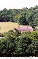
Architecture
The distinctive architecture that has evolved in the Blackdowns
is another reason given for the 1991 designation as an AONB. The
local materials of chert stone, cob, thatch and clay tiles survive
and are displayed in large quantities in the working houses that
were constructed for a largely agriculturally based population.
Many contain internal details dating back to medieval times, but
often these have been reworked in the 18th or early 19th century,
so that an undistinguished exterior can hide earlier origins. The
local vernacular continues to evolve with new designs and aspirations
beginning to play their part in the landscape. The many older buildings
that do survive are at risk from unsympathetic repairs and over
restoration. Barns are particularly at risk from conversions that
fail to respect their distinctive character and function.
|
|
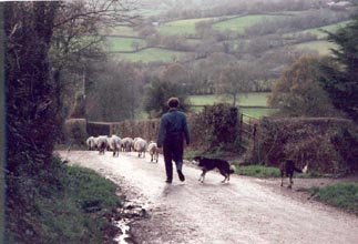
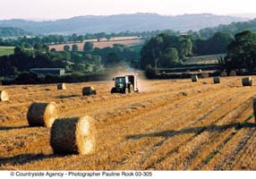
The Working Landscape
Traditional
Agriculture
The beautiful Blackdown landscape owes much to traditional agriculture
and thankfully this is still the largest industry in the Hills.
Predominately, this takes the form of wholesale milk production,
outdoor pig rearing and sheep farming with some arable farming.
|
|
Farm Diversification
Many farmers have found the need to diversify to retain liveable incomes, so it is also possible to spot the odd herd of Deer, Bison and Alpacas on the Hills.
Traditional Woodland Management
Traditional woodland management was once a key industry of the area, but sadly this is now in decline. Other uses are being sought for the extensive range of wooded areas within the Hills, which include increased recreational use, conservation and the revival of rural skills. Woodland materials are also seen as a natural resource for renewable energy and a series of biomass projects are currently being piloted in the area.
Accessibility �
Often thought of as remote, the Blackdown Hills are actually very accessible being close to a number of major roads, rail links and regional airports. This accessibility has attracted a diverse range of new businesses, ranging from home based IT, marketing, design and advertising companies to light engineering and specialist manufacturing companies. Former redundant farm buildings that once housed cows or sheep are now often filled with state of the art technology. |
|
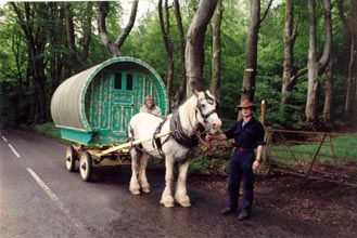
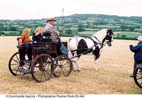
Exciting
Activities!
There is always something happening in the Hills, from Karting to
banger racing, gliding to sky diving, polo, horse racing and local
Gymkhanas to village fetes and Fairs.
A fantastic range of workshops and short courses for writers, those
wanting to discover their inner selves, artists, hedgerow skills,
cookery the list is endless.
For
a regularly updated Diary of Events see
www.blackdown-hills.net/diary.htm |
|
Exploring
The Blackdown Hills...
The visitor who enjoys a range of outdoor activities will delight
in the Blackdown Hills.
For those who
want to seek out history and heritage, there are two ancient Hill
Forts to explore, a wealth of churches and chapels, as well as the
remains of a Cistercian Abbey and a Castle. During the next couple
of years the World War 2 Airfields will attract veterans who travel
to the area to remember the events of 60 years ago.
The area has
seen some famous folks over the years - R D Blackmore, author of
Lorna Doone lived at Culmstock and Joseph Kennedy, one of the Kennedy's,
sadly lost his life at Dunkeswell during WW2.
Evidence of
the area's industrial heritage is still to be found, especially
at the working wool museum at Coldharbour. Visit Blackborough and
learn more about the Whetstone Mining industry, which was still
active up to the turn of the last century.
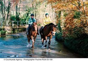
The best means
to really explore the area is by foot, bicycle (although you need
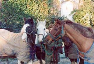
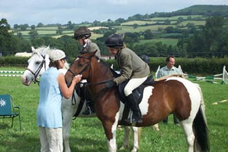
to be prepared to tackle a number of hills) and on horseback. The
area has some wonderful treasures to discover and often you will
feel that you are the first one to come across jewels such as the
Otterhead Lakes or the spectacular views from the tiny road that
abuts Henstridge Common. (Please note, though, that there is no access for horses and horses are not permitted at Otterhead -it is footpaths only).
For the more
adventurous there is the opportunity to sky dive, fly a glider or
pilot a micro-light.
For those who want a
quieter life, try a days fishing for Trout or Perch at a number
of different locations throughout the area.
www.blackdown-hills.net/enjoying2.htm
|
|
|
Food
& Drink...
The
Blackdown Hills is home to a mouth watering selection of food and
drink too. Drawing from the natural resources, producers have made
use of the landscape to create traditional and new products.
Over the centuries,
the Blackdown Hills has been self sufficient with the many landscape
features providing growing conditions suited to a variety of crops
and beasts. The farmers that work on the land have done so for years.
They still employ the traditional methods that result in the landscape
retaining the natural beauty and the food they produce tasting so
special. Sparkling fresh local produce can be sourced from a variety
of farm shops, or delivered directly to your door.
The area has
a wealth of traditional country pubs and small family run Hotels
that make use of homegrown food and B&B; providers' pride themselves
on producing tasty breakfasts using eggs, bacon and sausages from
neighbouring farms. Village shops are the lifeblood of local communities
and depend on local trade to keep going.
|
|
Hand
Made in The Blackdown Hills
The
tranquillity and sense of timelessness of the Blackdown Hills provides
inspiration for a huge range of artists and crafts people living
and working in the area.
|
Horse riding holidays, equestrian events and shows, horseback vacations, equine directory, good horsemanship, horse holidays, uk and worldwide
�
ADVERTISE on Equinetourism.co.uk - Click here
SEARCH FOR CONTENT ON EQUINETOURISM.CO.UK |
�
Also see www.EquineTourismCommunity.com and www.EquineTourism.com
email: [email protected] - Telephone 00 44 (0)1643 862785
www.EquineTourism.co.uk is owned by Happy Horses Ltd, Holt Ball, Luccombe, Minehead, Exmoor, Somerset TA24 8SZ
Full worldwide copyright and all rights retained �2004-2014 ongoing Happy Horses Ltd. Please read our Disclaimer
|